Soil and Water Conservation District
Important note: The Soil and Water Conservation District has moved to a new office location at the Public Works Service Center. Our new address is 1188 50th Street SE, Rochester, MN, 55904.
The mission of the Olmsted Soil and Water Conservation District (SWCD) is to promote more sustainable resources utilization and protection of natural resources in the county. The SWCD assists farmers, communities, watershed planners, and landowners in developing and implementing conservation and resource management systems and practices including tree sales. The SWCD also serves as a source for conservation and resource information and provides environmental education for county residents.
Staff can be contacted via phone at 507-328-7070 or by email at swcd@olmstedcounty.gov
About us
Staff
- Skip Langer - Soil Conservation Manager
- Caitlin Meyer - Water Resources Supervisor
- Scott Bennett - Conservation Technician
- Shona Langseth - Conservation Technician
- Jenna Rasmusson - Conservation Technician
- Angela White - Conservation Technician
- Martin Larsen - Conservation and Feedlot Technician
- Greg Klinger - Agricultural Water Quality Specialist
History
Soil and Water Conservation Districts were organized as a result of the 1930's "Dust Bowl." With the eight-year unrelenting drought in the early 1930s, overproduced land eroded and blew away with the wind. Black dust storms covered the nation with little visible sunlight.
Hugh H. Bennett was instrumental in the passage of the Soil Conservation Act of 1935. The act was the beginning of the Soil Conservation Service (SCS) agency of the US Department of Agriculture, which is known today as the Farm Service Agency. Programs were established to assist farmers with financial payments to apply new farming practices to their land. Conservation practices included planting trees for shelterbelts, crop rotation, contour, and strip plowing, and cover grasses.
To make private land conservation a success it would take local farmers acceptance and the promotion of new farming practices. President Roosevelt realized this and in 1937 appealed to states recommending legislation to allow the formation of Soil Conservation Districts by local landowners.
The Upper Zumbro Soil and Water Conservation District was established on September 25, 1940, under MS 103C as a governmental subdivision of the state. This District was to be the state's fifth established Soil and Water Conservation District.
The Upper Zumbro Soil and Water Conservation District encompassed eight Olmsted County townships and three Dodge County townships. On petition from farm owners, the nine remaining townships in Dodge County were added in September of 1944. In 1945 the remaining ten townships of Olmsted County were added. The division of Olmsted and Dodge Counties was decided in June of 1947. This resulted in the Upper Zumbro Soil and Water Conservation District encompassing all of Olmsted County as it is today. It wasn't until October 10, 1978, that the District changed its' name to what we know it as "Olmsted Soil and Water Conservation District."
Olmsted SWCD Board of Supervisors
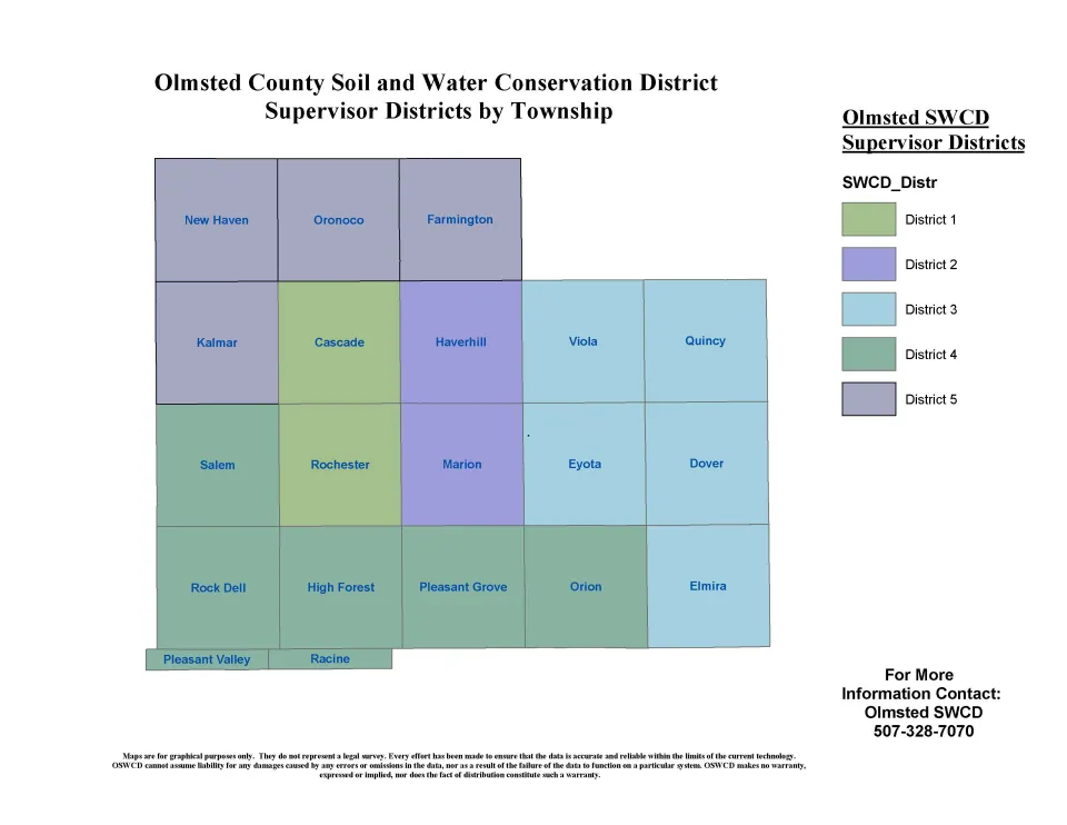
The local unit of government with five locally elected supervisors provides local leadership and direction for putting conservation on the land. The board coordinates the activities of the Federal, State, and local agencies to provide conservation services and monies, develops conservation plans, educational programs, technical information, and demonstrations with the expertise of Olmsted County staff, and works with farmers, other individuals, cities, townships, and counties to plan and install conservation measures.
2025 Olmsted SWCD Board Supervisors
District 1: James Rentz
District 2: Paul Uecker
District 3: Cheryl Winters
District 4: Joe Himmer
District 5: Louis Seifert
2025 Committee Representatives
TSA 7: Paul Uecker
Whitewater Joint Powers Board (WWJPB): James Rentz
South Zumbro Watershed Joint Powers Board: Cheryl Winters
WinLaC 1W1P Policy Committee: Cheryl Winters
Root River 1W1P Policy Committee: Joe Himmer
Greater Zumbro Policy Advisory Committee: Louis Seifert
Groundwater protection and soil health initiative
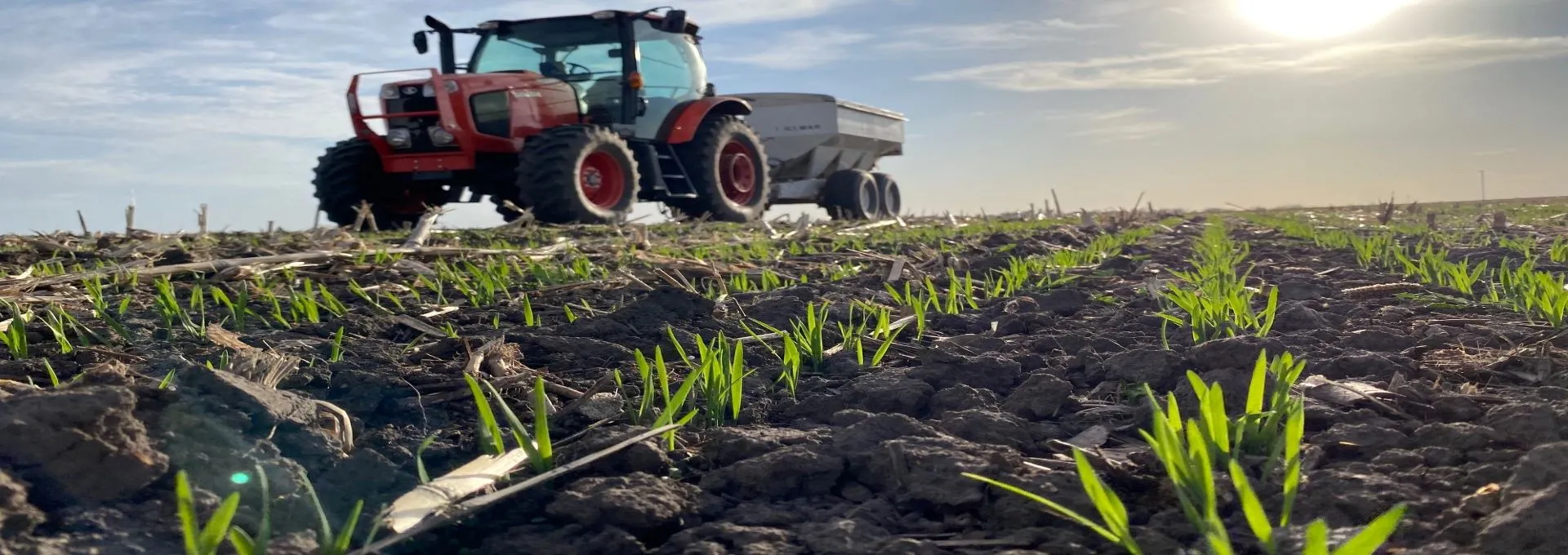
A new program for groundwater protection and soil health is rolling out to Olmsted County farm operators through the SWCD. Farm operators in Olmsted County can use cost-share through this program to integrate small grains or alternative crops into their traditional cropping systems, expand haying and grazing acres, and plant cover crops.
In 2023, the program featured two additional enrollment options for farm operators. Enrollment options include cost-share for small grain and alternative crops, increasing haying and grazing acres, and continuation of the cover crop program. Applications can be found on the Olmsted County Groundwater Protection and Soil Health Program website or by clicking on the application bubble below.
Please review the policy and requirements below prior to applying for the program.
Additional programs
AgBMP Loan Program
The State Revolving Loan (SRF) Program better known as the AgBMP Loan Program is a water quality improvement program that provides 3% low-interest loans up to $200,000 to farmers, rural landowners, and agriculture supply businesses. The purpose of the program is to provide loan opportunities for any activity or practice that helps to improve water quality, or that helps maintain high water quality. Common practices eligible for the loan include Ag waste (manure) storage, manure application equipment, conservation tillage, and no-till equipment, erosion control practices, and replacement of failing septic systems, including individual or cluster home sewage treatment systems. See the full list of possible practices here.
For more information about the program contact the Olmsted SWCD at 507-328-7070 or visit the MDA website.
View the Interactive map of lender program participation in the program.
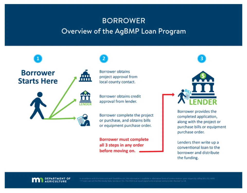
Diagram demonstrates the process for applicants to apply for a loan and receive AgBMP funding.
State Cost Share Program
The Olmsted SWCD has state funding available to share in the cost of building practices for the purpose of erosion control, sedimentation control, and water quality improvement that are designed to protect and improve soil and water resources in the county. Through the State Cost Share Program, land occupiers and owners can request financial and technical assistance to implement conservation practices. The program can provide up to 75% of the cost of installing the practice. In Olmsted County, our most common Best Management Practices (BMP) are Grassed Waterways, Water and Sediment Control Basins (WASCOB), Terraces, Grade Stabilization Structures, and Cover Crops.
Grassed Waterway: A grassed waterway is a shaped or graded vegetated channel established to convey concentrated surface water flows at a non-erosive velocity across the landscape to a stable outlet. Grass waterways are constructed to control gullies and improve the water quality of downstream water bodies by reducing the sediment load carried by surface water runoff. Technical assistance and cost-sharing are available to landowners and producers to establish new or repair existing grassed waterways.
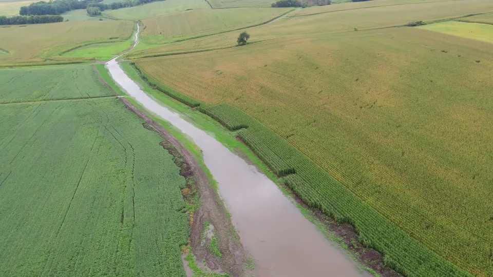
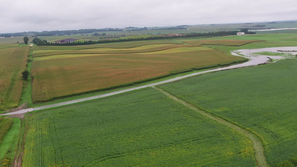
Caption: Grass waterway conveying water after a storm event. This grass waterway was designed and constructed with technical assistance from the Olmsted SWCD.
Water & Sediment Control Basin (WASCOB): A WASCOB is an earthen embankment constructed across the slope of minor drainage ways where they intercept, temporarily store and slow runoff flows. The purpose of this practice is to reduce gully erosion, trap sediment and manage surface water runoff. The WASCOB detains runoff and slowly releases it allowing sediment to settle. WASCOBs generally use an underground tile system to control the release and carry the runoff in a pipe to a stable outlet location. Technical assistance and cost-sharing are available to landowners and producers to establish new or repair existing water and sediment control basins.
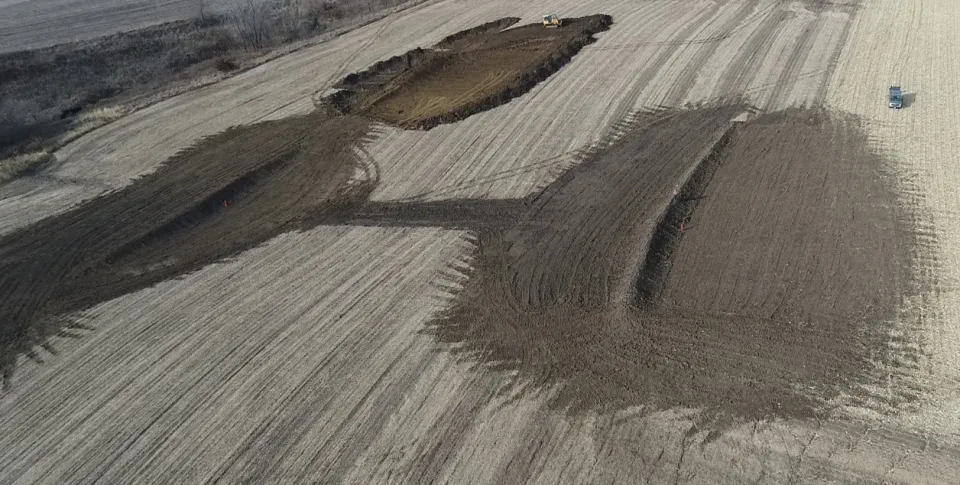
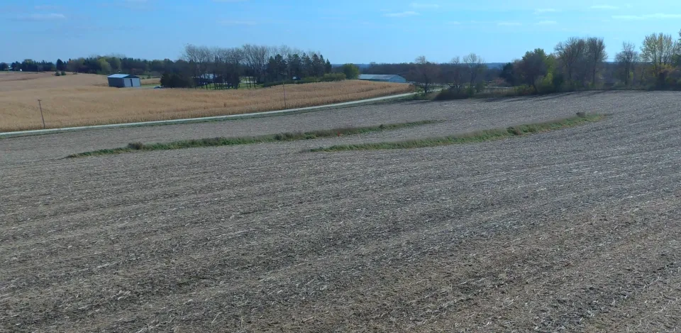
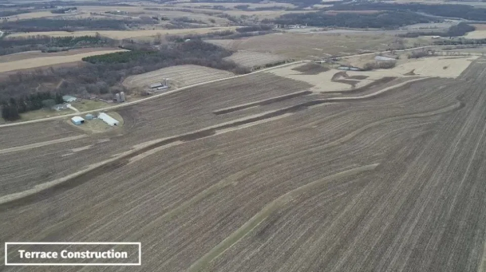
Terraces: A terrace is an earthen embankment with a combination ridge and channel constructed on the contour and across slope to intercept surface water runoff. This practice generally applies to cropland. Terraces can be installed to reduce the slope length for erosion control, intercept and convey runoff to a stable outlet, trap sediment, prevent gully development and improve farmability. Technical assistance and cost-share is available to landowners and producers to establish new or repair existing terraces.
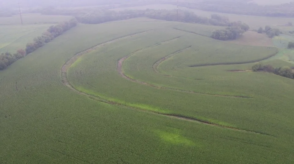
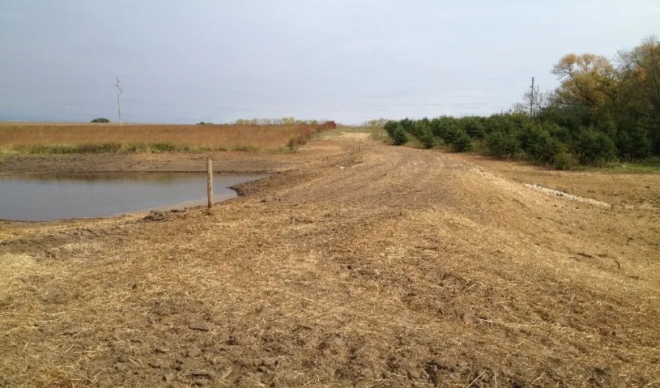
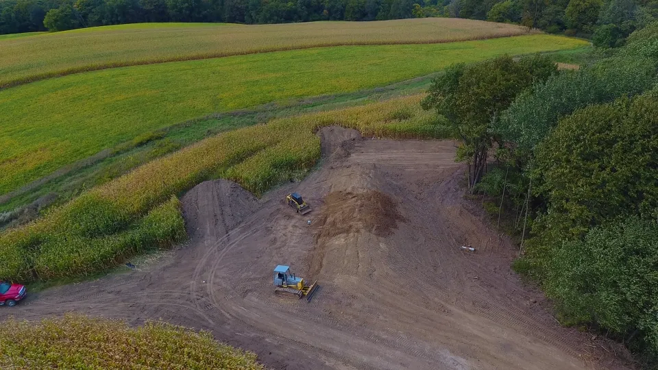
Grade Stabilization Structures/Ponds: A grade stabilization structure is an earthen embankment that impounds storm event runoff and manages the discharge, typically with a metal or plastic pipe. These embankments can either be dry except during rain events or can have a pool of water. They are typically located along the edge of wooded ravines where there is a gully head-cut eroding into the cropland. These practices help stabilize gullying on steep grades, reduce erosion and improve water quality by slowing the flow of water draining off the landscape. Technical assistance and cost-sharing are available to landowners and producers to establish new or repair existing grade stabilization structures.
Cover Crops: Cover cropping is a soil health practice where a single or multiple species mix of grasses, legumes, or brassicas are planted after or into a growing cash crop (corn, soybeans, canning crops ) with the purpose of reducing soil erosion and improving the quality of the soil. Cover Crops are an important part of the Five Principles of Soil Health; 1) Armoring the Soil 2) Minimizing Soil Disturbance 3) Increase Plant Diversity 4) Have a Continual Living Plant Root 5) Integration of Livestock. Cover crops with growing roots on either side of a typical annual cash crop provide a great way to armor the soil by leaving additional plant residue on the soil surface to protect from wind or water erosion. Currently, cost-share is available to producers who have not implemented cover crops into their management system. Cost-share contracts are 3 years and help offset the cost of seed, planting, and termination of the cover crop.
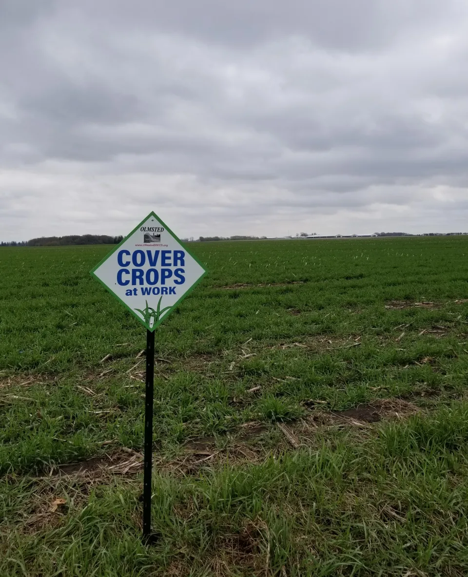
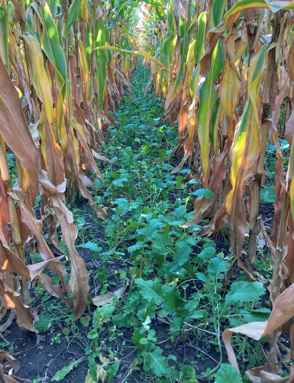
To learn more about cover crops, contact our office at 507-328-7070 to talk with SWCD staff or check out these additional resource links:
Minnesota Office of Soil Health
Minnesota Soil Health Coalition
Well Sealing: An unused or abandoned well that has not been properly sealed can provide a direct pathway for contaminants to enter our groundwater. Contaminants from surface water runoff or other sources such as leaking sewers or failing septic system drain fields can enter the well through a well casing that has deteriorated. State law requires that all unused or abandoned wells must be sealed. The Olmsted SWCD can provide 50% up to $1,200 in cost-sharing funds to seal wells that may pose a threat to the groundwater supply. The well must be sealed by a licensed well contractor or a licensed well-sealing contractor and must be completed in accordance with Olmsted County Planning and Zoning Well Sealing Permit requirements.
Minnesota Buffer Initiative on Public Waters
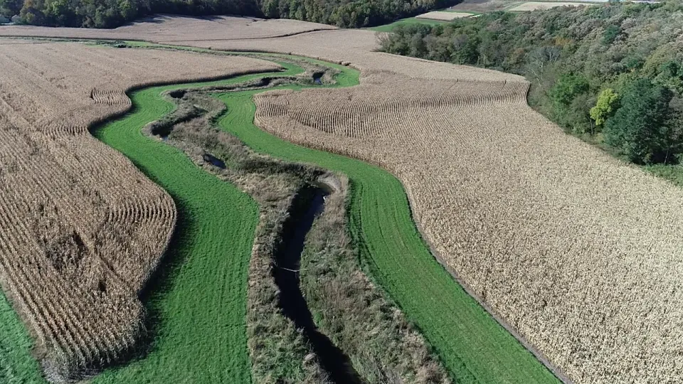
Caption: Photo of a vegetative buffer along a public water located in Olmsted County
Vegetative buffers provide multiple benefits for water quality. The perennial vegetation adjacent to the stream or riverbank can help armor soil and prevent erosion during small storm events. Vegetation works to trap sediment and filters out nutrients and pesticides that may be carried in surface water runoff from adjacent farmland before it enters streams, rivers, lakes, and wetlands. The vegetative buffers also provide critical wildlife habitat and riparian corridor connectivity that is essential for local wildlife.
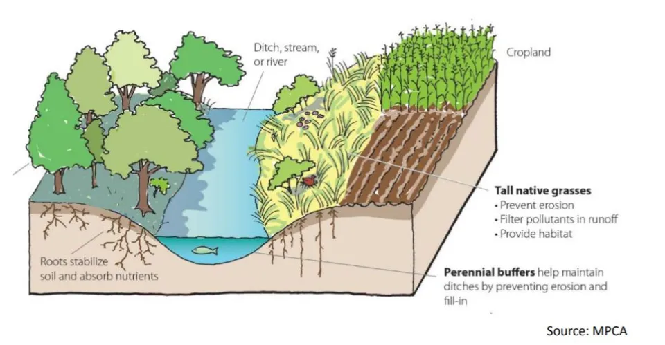
Caption: Diagram of the benefits of a vegetative buffer
In 2015, the Buffer Initiative Rule was enacted by the Minnesota state legislature requiring an average of 50 feet of perennially vegetated buffer on all public water streams in Minnesota. Olmsted County’s Shoreland Ordinance is slightly more restrictive stating that a 50-foot vegetative buffer is required on all land adjacent to public waters. A public water is defined by the Minnesota DNR as “natural and altered watercourses with a total drainage area greater than 2 square miles in area and/or a natural and altered watercourse designated by the DNR commissioner as a trout stream”.
Most would consider a public water a stream or river with some amount of consistent flow throughout the year but under the DNR’s definition, it also includes streams with defined bed and banks that may only have intermittent flows during or after a precipitation event or following spring snowmelt. Some of the county’s public waters are designated in areas where there is a constructed grassed waterway to convey this intermittent concentrated flow of surface water across the landscape in a stable manner.
If you would like to find out if your property has a public water, visit the DNR’s interactive map
Olmsted SWCD has been tasked by the State of Minnesota to work with County landowners who own property with DNR designated public water to ensure compliance with the State Buffer initiative and Olmsted County Shoreland ordinance. SWCD staff can ensure that the 50-foot strip of perennial vegetation is measured and flagged properly from the top of bank along public water. All county parcels, nearly 3000, meeting the buffer requirement will be reviewed for compliance once every three years by the SWCD. If you have questions or concerns regarding the vegetative buffer on your property or would like staff from the SWCD to complete a site visit to ensure the buffer meets the state’s requirements, you can contact the Olmsted SWCD at 507-328-7070 or email: swcd@olmstedcounty.gov
To learn more about how you can improve the buffer on your property, visit the Board of Soil and Water Resources (BWSR) to view Building Better Buffers Series Fact Sheets.
MN CREP & RIM
MN CREP (Conservation Reserve Enhancement Program)
MN CREP is a voluntary, federal-state funded natural resource conservation program that uses a science based approach to target environmentally sensitive land in Olmsted County and throughout Minnesota. Permanent protection is accomplished by establishing conservation easements via payments to farmers and agricultural landowners by the state.
Current program available practices:
1. Grass Filter Strips
2. Wetland Restoration - Non-Floodplain
3. Wetland Restoration – Floodplain
4. Wellhead Protection Areas
For more information on the current CREP program or other land protection opportunities that may be available for you, please contact Aaron Gamm with the Olmsted Soil and Water Conservation District at 507-328-7070.
Learn more about CREP at the MN Board of Water and Soil Resources (BWSR) website.

RIM (ReInvest in Minnesota)
The Minnesota Board of Water and Soil Resources (BWSR) acquires, on behalf of the state, conservation easements to permanently protect, restore and manage critical natural resources without owning the land outright. The land remains in private ownership and the landowner retains property rights, has responsibility for maintenance and paying applicable real estate taxes and assessments. BWSR provides state-level program coordination and administration while implementation at the local level is undertaken by county Soil & Water Conservation Districts (SWCDs).
Any questions regarding current RIM enrolled land or possibility of future opportunities please contact Aaron Gamm with the Olmsted Soil and Water Conservation District at 507-328-7070.
Learn more about RIM at the BWSR website.
Stream & River Sampling
The federal Clean Water Act requires states to adopt water quality standards to protect lakes, streams, and wetlands from pollution. The standards define how much of a pollutant (bacteria, nutrients, turbidity, mercury, etc.) can be in the water and still meet designated uses, such as drinking water, fishing, and swimming. A water body is “impaired” if it fails to meet one or more water quality standards. The Minnesota Pollution Control Agency (MPCA) is responsible for assessing the lakes and streams in Minnesota for impairments.
For more information on Olmsted Soil and Water Conservation District’s monitoring efforts, please contact Aaron Gamm at 507-328-7070.
Watershed Pollutant Load Monitoring Network (WPLMN): Catching the flush of pollutants is the job of the Watershed Pollutant Load Monitoring Network. This network of state and local partners monitors the quality of major rivers throughout Minnesota.
The MPCA uses the data to guide studies and Watershed Restoration and Protection Strategies (WRAPS) it develops with local partners. Local partners then use the data for planning and to implement best management practices in priority locations that restore or protect Minnesota’s waters.
Their work is important for detecting whether water quality is getting better or worse, tracking the impact of restoration work, and identifying sources of pollution and ways to reduce them. See interactive data and more information here.
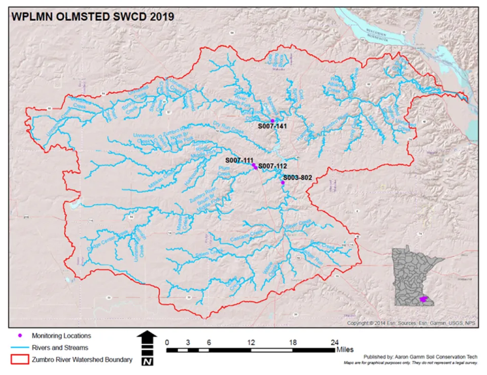
Monitoring locations in the Zumbro River watershed administered by Olmsted SWCD.
Surface Water Assessment Grant (SWAG): The primary objective of this program is to determine the health of lakes and streams in Minnesota. Through state funded monitoring projects, local partners collect data on surface water quality to identify lakes and streams to target for restoration or protection strategies. The MPCA focuses these strategies at the major watershed scale. See more information here.
Citizen Stream Monitoring Program (CSMP): Join more than 1,400 Minnesotans who track the health of their favorite lake or stream by volunteering to become a citizen water monitor today! Volunteers measure the water clarity of lakes and streams, and the MPCA uses that valuable data to make decisions on watershed protection and restoration. For some lakes and streams, volunteer monitoring provides the only data available to guide decision making processes, making this work indispensable. See more information here.
Funding for the Environment in Minnesota
Clean Water, Land and Legacy Amendment: In 2008, Minnesota's voters passed the Clean Water, Land and Legacy Amendment (Legacy Amendment) to the Minnesota Constitution to: protect drinking water sources; to protect, enhance, and restore wetlands, prairies, forests, and fish, game, and wildlife habitat; to preserve arts and cultural heritage; to support parks and trails; and to protect, enhance, and restore lakes, rivers, streams, and groundwater.
The Legacy Amendment increases the state sales tax by three-eighths of one percent beginning on July 1, 2009 and continuing until 2034. The additional sales tax revenue is distributed into four funds as follows: 33 percent to the clean water fund; 33 percent to the outdoor heritage fund; 19.75 percent to the arts and cultural heritage fund; and 14.25 percent to the parks and trails fund.
Environment and Natural Resources Trust Fund: In 1988, Minnesota's voters approved a constitutional amendment establishing the Environment and Natural Resources Trust Fund (Trust Fund). The purpose of the Trust Fund is to provide a long-term, consistent, and stable source of funding for activities that protect and enhance Minnesota's environment and natural resources for the benefit of current citizens and future generations.
The money in the Trust Fund originates from a combination of contributions and investment income. Forty percent of the net proceeds from the Minnesota State Lottery are deposited to the Trust Fund each year; this contribution is guaranteed by the Minnesota Constitution until December 31, 2024. The Trust Fund may also receive contributions from other sources such as private donations.
For Information visit Clean Water Funding in Minnesota
Tree sale | Plant kits & seed mix sale
Olmsted County sells trees and shrubs in bundles of 20 to 25 bare-root transplants (2-3 years old). This is an inexpensive way to add color and beauty to your property. Customers pickup product mid-April at Graham Park. The 2025 plant and seed sale will end May 4, at 11:59 p.m.
Olmsted County also sells seed mixes and plant kits. All seed mixes are comprised of local-ecotype seed native to Minnesota. The plant kits are one flat, containing 36 plugs of 6 different species.
Subscribe for SWCD tree/plant/seed sale notifications via email and/or text messages.
Questions?
Please contact our office at 507-328-7070.
Purchase a plat book

The 2025 Plat Book is currently on sale now. Plat books are typically published every four years. The cost for a plat book is $36.99 plus tax.
You can find more recent information through Olmsted County GIS Services. However, information with "in-process" status is not available until officially recorded.
You can purchase a plat book at any of these locations:
Soil and Water Conservation District
1188 50th St SE
Rochester, MN 55904
Olmsted County Government Center
Property Records Licensing
151 4th Street SE
Rochester, MN 55904
Environmental Resources
2122 Campus Drive SE Suite 200
Rochester, MN 55904
We accept: cash, check, credit/debit card. (There is a 2.49% convenience fee for all credit/debit card purchases.)
Wetland Conservation Act (WCA)
Wetlands 101: What to know before you work
Minnesota’s landscape includes roughly 10.6 million acres of wetlands. While many people think of wetlands as swampy, marshy areas with standing water and cattails, the reality is wetlands take on many forms. In addition to swampy, marshy areas, wetlands can vary from grassy meadows, to forested wetlands covered in trees and shrubs, to wet areas of cultivated farm fields. Many wetlands are actually dry for most of the year, with no standing water.
Why wetlands matter?
Before European settlement, studies estimate Minnesota had over 20 million acres of wetland. Today that number has been cut in half. Wetlands are important ecosystems. They hold water, providing for natural water quality improvements by filtering nutrients and sediment that might otherwise pollute and clog waterways. They provide flood protection and shoreline erosion control. Wetlands are also home to many species of fish and wildlife.
Wetlands regulation
Most wetlands in Minnesota are protected by State and/or Federal law, and in some cases by local ordinances. Minnesota’s primary wetland protection law is the Wetland Conservation Act. The law is implemented by local governments, the Minnesota Board of Water and Soil Resources provides assistance and oversight, and the Department of Natural Resources provides enforcement. The State law applies to all wetlands, including those on private property, to achieve “no net loss” of wetlands. In general, wetland protection laws regulate activities in or near wetlands that can negatively affect the wetland through draining, filling, or excavating. There are some exemptions contained within State law for certain activities.
What you should know
It can be very difficult to identify wetlands and wetland regulations can be quite complex. Some examples of projects that could potentially affect wetlands include:
- Tiling wet areas of cultivated fields
- Digging a pond in a low area
- Cleaning out an old ditch or improving an existing ditch
- Adding fill for a crossing of a stream or wet swale
- Filling a low area of a residential lot for a building or lawn
Requirements
If there is the potential for your project to impact a wetland, before you start it is important to contact your local WCA regulatory authority to:
- Find out if the land you intend to alter is a wetland. Remember, an area can be a wetland even if it does not appear wet on the surface.
- Determine if the proposed activity has impacts to a wetland area.
- Assure that any impact to wetlands can be avoided if possible, and properly replaced if not.
If you don’t know where to start, your local Soil and Water Conservation District can help you determine which agency is your local contact.
Cooperation is a key component of successful conservation. Local, state, and federal wetland regulatory agencies work in partnership with landowners to help them achieve the best possible results on their private land.
In Olmsted County, contact the Olmsted Soil and Water Conservation District for more information about your property and how your project could impact wetlands. Contact us by phone at 507-328-7070 or by mail at 2122 Campus Drive SE, Suite 200 Rochester MN 55904.
Budget & Operational Plan
Olmsted Soil and Water Conservation District
2021 budget
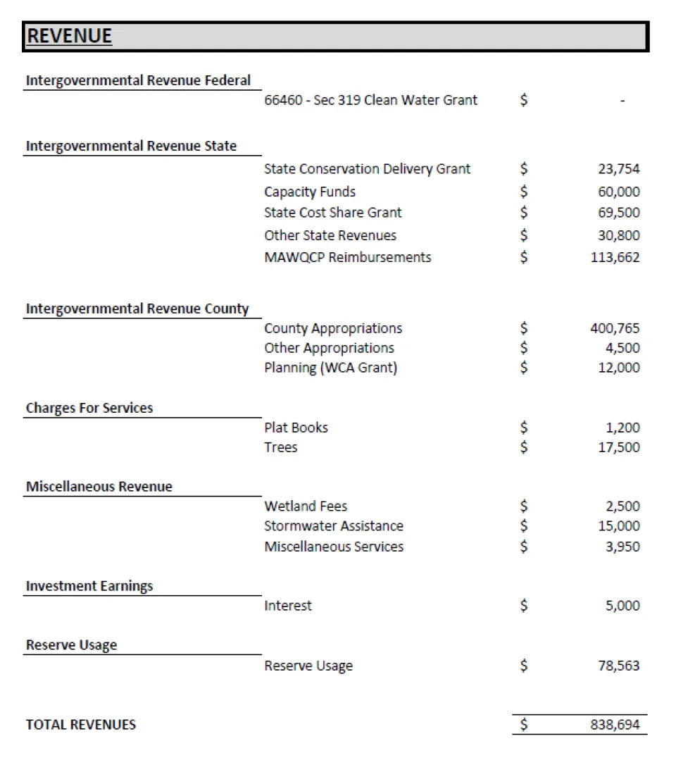
Financial report & audits
Helpful links
- Whitewater Joint Powers Board
- University of Minnesota Extension Office - Soil Testing
- Minnesota Water and Soil Resources Clean Water Fund stories
- MS4 Stormwater
2023 Year in Review

